Infrastructure planning

Let’s design
reliable infrastructure

Use detailed data and analyses to evaluate how infrastructure designs affect surface water.

“We can visualize the conditions that will arise after the construction of a railway embankment. This allows us to predict how water will behave after such terrain changes.”

Jakub Wilinski
GIS Team Coordinator, Poland

I can import our infrastructure designs to evaluate how it will affect stormwater. We can dimension culverts when we know where and how much water we need to manage.

Erik Jaatinen
Engineer, Finland

I imported a road model in 5 cm resolution to make very detailed estimations of storm water volumes in the planned SuDS scheme.

Francesco Righetti
Consulting Engineer, Norway

Flood mitigation

See how EPG created space for water around railways in the UK.

“SCALGO Live was integral throughout the whole project. We used the initial SCALGO Live visuals to win the tender.”

Let’s work with your
infrastructure project

Explore surface water along road- and railways

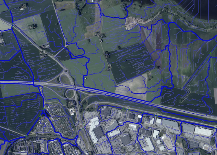
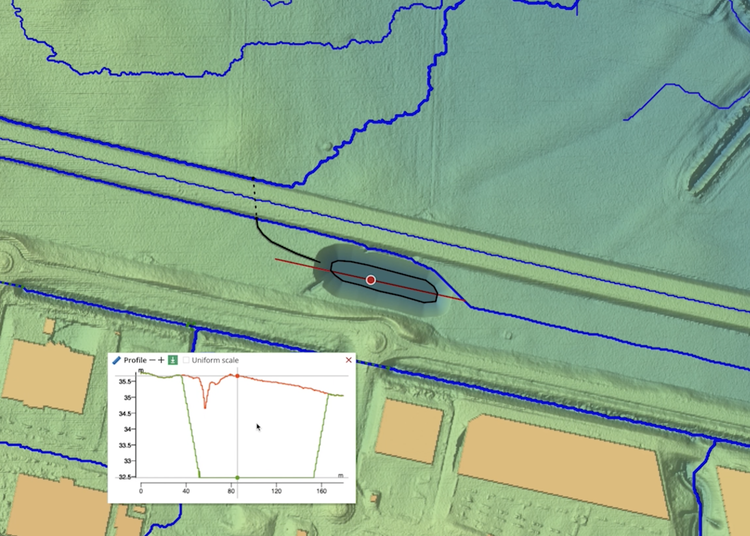
Wondering how water flows under and around infrastructure?

Evaluate interactions between surface water, terrain, and the built environment – this helps you explore how culverts, streams, and basins should be placed.

Experiment with your infrastructure designs

Are you looking for ways to improve your designs?

Start your design work in SCALGO Live or import an existing design and start experimenting with ways to divert and retain water around your infrastructure.

Create reliable infrastructure

Would you like robust surface water systems to protect roads and rails?

When we build railroads, highways, and other important infrastructure, natural waterways are altered. SCALGO Live lets you manage surface water properly.