Country Specific – Finland
Quick Facts KM2
| Cell Size | 2x2 m |
| Coordinate System | ETRS-TM35FIN |
| Vertical Reference | N2000 |
| Flight Years | 2008–present |
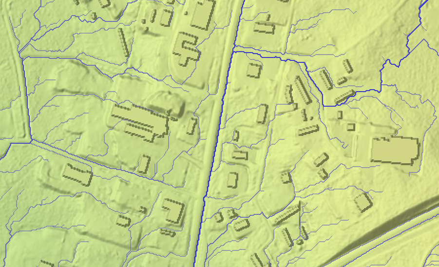
Our elevation model of Finland is based primarily on the 2 m elevation model (Suomi: Korkeusmalli 2 m, KM2) made available by the National Land Survey of Finland (MML). Laser scanning for this model has run from 2008 to 2022. Detailed information on when data was collected for which area is available from MML. We strive to keep our model up to date with the latest sources, but note that in Finland the new 5p laser scanning data is not automatically used for creating a new elevation model. Instead, the elevation model is only updated in areas where land use has changed. The reason is that most of the data collection is done in the Summer with very dense vegetation, which means that foliage introduces a lot of noise when trying to measure the surface elevation.
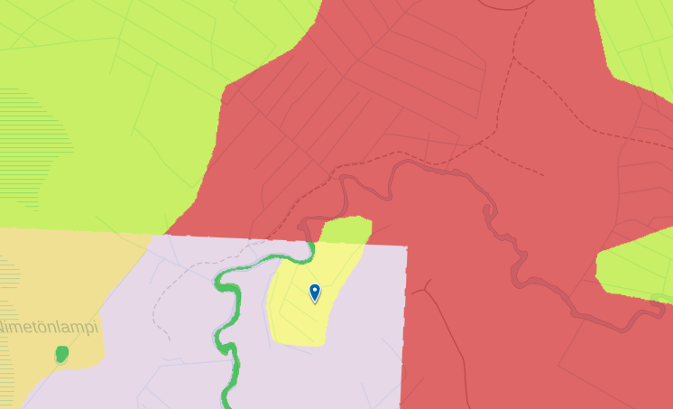
For the areas around Helsinki and Lahti, we use 1 m models provided by the respective municipalities (red and purple areas in the figure below). To accommodate this 1 m data, all analyses and workspace computations are done in 1 m resolution for the whole country.
In order to use an elevation model for hydrological analysis such as watershed and flow accumulation computations, three conditions need to be met:
- The upstream area of any river should be covered by the elevation model.
- Structures on top of the terrain should only be present in case they actually block water from flowing under or through them.
- Structures transferring water below the terrain surface should be taken into account.
Below, we discuss how we process the model to fulfil these conditions as well as possible.
Extensions
In order to cover all of Finland including upstream areas of all rivers, we have extended the model in the following areas:
- For the parts of Finland not covered by KM2, we use the 10m elevation model from MML.
- To cover the full upstream areas of some rivers in northern Finland, we included data from Norwegian Kartverket's national detailed elevation model (NDH) project, DTM1, as well as Kartverket's DTM 10 dataset from 2013.
- To cover nearby areas in Sweden, we included data from Lantmäteriet's Markhöjdmodell Nedladdning, grid 1+.
- To cover nearby areas in Russia, we included data from the 30-meter EU-DEM data set, which in turn is based on SRTM and ASTER GDEM data.
A full overview of which data source is used for which part of the model
is available by clicking the gear icon next to an elevation layer, selecting the "Source" tab, and "Show source information". Use point query to see more details for individual areas, as provided by MML. Multiple styles are available for this layer to colour sources by e.g. collection date.
Buildings
Buildings have been removed from the terrain model during construction. When computing water flow paths, more realistic results are generally obtained when the elevation model does include buildings so water can be simulated to flow around them. In SCALGO Live, we accomplish this by adding buildings back into the model using a data set of building footprints, where we raise all grid cells covered by a building to a height 10 meters above the highest terrain point within the building footprint. This model is called "Terrain/Buildings" and is the basis for all nationwide hydrological computations.
The building footprints are taken from the Topographic Database (Suomi: Maastotietokanta) from MML.
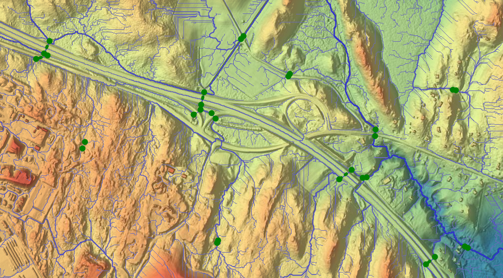
Bridges, underpasses and hydrological corrections
Major bridges have generally been removed from the KM2 model, but for many smaller bridges and underpasses, as well as for larger structures in the areas around Helsinki and Lahti, additional hydrological corrections that allow water to flow through such structures are necessary. SCALGO Live Finland includes a nationwide hydrological correction set constructed primarily based on the Topographic Database (Suomi: Maastotietokanta) from MML. Corrections have been generated at locations where the river network intersect roads, railroads, dams, or buildings, as well as at river sections in urban areas marked subsurface ("Pinnan alla") where the river e.g. runs through a longer covered/piped area. Secondly, corrections have been generated at road overpasses and tunnels. Each correction thus follows a line in the river or road network, with end points adjusted to match the elevation model as well as possible. In places where the elevation model is already hydrologically corrected (e.g. at large bridges), corrections are not generated.
This data set is machine-generated, so some errors should be expected. However, since we only include corrections along known river and road lines, we believe it to be conservative in terms of water flow.
The set of corrections is available under the Hydrological Corrections category in the Library.
The national analyses use these corrections, and workspaces created using the predefined "Flash Flood Map" or "Sea-Level Rise" buttons also include them by default. If you create a workspace through any other means than the predefined buttons (e.g. if you upload your own model), you can include corrections in that workspace through the workspace Actions tab by clicking Import corrections, they will not be included automatically.
Soil type, land cover, and land use
Land cover
The land cover map is produced by SCALGO in collaboration with the Finnish Environment Institute (SYKE). It is based on machine learning techniques at a resolution of 25 cm. We refer to the land cover section for more details.
Land use (maankäyttö)
There is an additional land cover layer available in SCALGO Live Finland. We use the area type (20m resolution) from the Finnish Environment Institute (SYKE) for watershed land use queries. The dataset is based on automated interpretation of satellite images and data integration with existing digital map data. The source material is generally from 2016-2017. We refer to Corine Land Cover 2018 for more information.
Regional landuse use (Helsingin seudun maanpeite)
SCALGO Live uses the Regional Land Cover Data 2022, a land cover classification material covering the Greater Helsinki and Kirkkonummi and Kerava areas, based on color-infrared aerial image interpretation. This land cover dataset has been developed by SCALGO in collaboration with the Helsinki Region Environmental Services (HSY). The land cover classification divides the area into water impermeable, green, rocky, bare soil and water areas.
In the data, bare soil and other impermeable surfaces are problematic categories with respect to each other and should be treated as one class.
We refer to HSY Map for more information.
Soil type (maalajit)
SCALGO Live uses superficial deposits data from the Geological Survey of Finland. We combine two soil type datasets called Maaperä 1:20000/1:50000 and Maaperä 1:200000. Maaperä 1:20000/1:50000 is used by default, but it does not cover the entire area of SCALGO Live Finland. Where Maaperä 1:200000 is not available we have used the coarser-resolution Maaperä 1:200000.
If a category is the same in both datasets, it will be merged into one category, e.g., "Lieju" (Mud) is present in both datasets. Where Maaperä 1:20000/1:50000 has finer categorization than Maaperä 1:200000, we show Maaperä 1:20000/1:50000 as a separate subcategory. For instance, "Liejuinen Hiekka" (Muddy Sand) is only present in Maaperä 1:20000/1:50000. In that case we include a subcategory as "Liejuinen Hiekka" under the general category "Lieju". Note also that "Lieju" from either dataset is included as the subcategory "Lieju" under the general category "Lieju".
To create a detailed map of topsoil types, we start by mapping the soil types in the dataset above intro JB-based soil types using the table below. Hereafter we enhance the map using our land cover map. Please refer to the soil properties page for more information.
| GTK | JB-based Soil Type |
| Hiekka | Coarse sand |
| Hiekkamoreeni | Coarse sand with clay |
| Hiekkamoreeni, Soramoreeni | Coarse sand with clay |
| Hieno Hieta | Fine sand |
| Hienoainesmoreeni | Fine clay with sand |
| Hienojakoinen maalaji, päälajitetta ei selvitetty | Fine clay with sand |
| Hiesu | Silt |
| Kalliomaa | Bedrock |
| Kalliomaa (Ka) RT | Bedrock |
| Kalliopaljastuma | Bedrock |
| Karkea Hieta | Fine sand |
| Karkearakeinen maalaji, päälajitetta ei selvitetty | Coarse sand |
| Kartoittamaton | Bedrock |
| Kiviä | Rocks and boulders |
| Lieju, humuspitoisuus yli 6% | Gyttja/peat |
| Liejuhiesu, humuspitoisuus 2-6% | Silt |
| Liejuinen Hiekka | Coarse sand |
| Liejuinen Hieta, humuspitoisuus 2-6% | Fine sand |
| Liejuinen hieno Hieta, humuspitoisuus 2-6% | Fine sand |
| Liejuinen hienorakeinen maalaji | Fine sand |
| Liejusavi, humuspitoisuus 2-6% | Clay |
| Lohkareita | Rocks and boulders |
| Ohut turvekerros | Gyttja/peat |
| Paksu turvekerros | Gyttja/peat |
| Rahkaturve | Gyttja/peat |
| Rakka | Bedrock |
| Rapakallio | Bedrock |
| Saraturve | Gyttja/peat |
| Savi | Clay |
| Sekalajitteinen maalaji, päälajitetta ei selvitetty | Fine clay with sand |
| Soistuma | Gyttja/peat |
| Sora | Gravel |
| Soramoreeni | Coarse clay with sand |
| Turvetuotantoalue | Gyttja/peat |
| Täytemaa | Coarse sand with clay |
| Vesi | Water |
The Flash Flood Map supports the use of runoff functions to specify the runoff generated from each cell as a function of the rain depth. In Finland we have produced a national Flash Flood Map where we use runoff functions to include infiltration and drainage to sewers in the model. When you enable infiltration and drainage in the Flash Flood Map, the infiltration at a cell is determined by the cell’s land cover class as well as its topsoil type (in natural areas) and sewer map status (in artificial areas).
For artificial surfaces, we distinguish between those that are expected to be served by sewer systems, and those that are not. We assume that all artificial surfaces within an urban zone are connected to a sewer system, while all those outside these zones are not. For the artificial surfaces connected to a sewer system, we calculate the runoff as the rainfall minus the expected capacity of the sewer system, defined by a CN-p curve. For all other artificial surfaces we assume 100% runoff.
For natural surfaces, we generally calculate the runoff as the rainfall minus the infiltration, using CN-p curves. The infiltration is assessed based on the topsoil type and the expected degree of compaction, which is assessed based on the land cover class.
For more information about the Flash Flood Map with infiltration and drainage, including information about parameter settings and CN-p curve numbers, we refer to our in-depth whitepaper (the whitepaper will be released soon).
Data from the topographic database, cadastral map, and administrative subdivisions
The SCALGO Live setup for Finland includes separate layers showing data from the Topographic Database (Suomi: Maastotietokanta), including building footprints, roads and water lines, as well as data from the Cadastral Map (Suomi: Kiinteistörekisterikartta) including administrative subdivisions. These layers are updated weekly from MML.
The topographic database uses some numeric codes to encode various categories (e.g. building types, data sources, etc.). These codes are translated in point query results in SCALGO Live using the specification from MML.
Rain events
In the Core+ module DynamicFlood, Scalgo Live provides a set of design rain events with varying return periods for use in the simulations. These rain events were based on IDF curves from the RATU report (Aaltonen et al., 2008). The rain events were created following the Chicago Design Storm method.
Urban and sewered areas
To determine whether an area is to be considered sewered (affecting the fate of rainfall on artificial surfaces in the Flash Flood Map with infiltration, see above, and the fate of all water on artificial surfaces in DynamicFlood) we use the map Asemakaavoitettu alue from Syke (can be found in the Library). We assume that all artificial surfaces that fall within a polygon in this map are connected to a drainage system, and that all artificial surfaces that fall outside these polygons are not connected to a drainage system.
We set the maximum capacity of the drainage system in DynamicFlood in Finland to 20 mm/hr. This value was chosen to reflect common historical dimensioning practice in Finland.
To determine whether an area is to be considered urban (affecting some soil types in the topsoil map), we use the same map as for sewered areas.