About – What's New
Updated orthophotos
New nationwide orthophotos are now available on SCALGO Live for both visualization and download. The orthophotos were released by Styrelsen for Dataforsyning og Effektivisering earlier this month (release notes) and were sourced in 2015.
Nationwide hydrology on the new DHM/2015 model now available
We have updated the Denmark/2015/Sea sea-level rise analysis, as well as the Denamark/2015/Rain watersheds and flow accumulation on the flooded model to have national coverage*. Previously, these layers were only available for Eastern Danmark. Interactive watershed queries using the watershed tool are also available nationwide.
For important information about hydrological corrections, please see our note.
We have also added a sea-level rise computation based on the DHM/2015/Sea model.
(*) A few minor sections are not yet available due to missing data in the initial versions of the model put out by SDFE.
New flash flood map computation available with watershed download
The national flash flood map computation has been updated (see message below). We have also added a new feature; the watershed maps for the flash flood map rain events (i.e. the 10mm, 20mm, ..., 10cm watershed maps) are now available for download.
DHM/2015 variants and sea-levels now available nationwide
We have updated the Denmark/2015/Rain and Denmark/2015/Sea to have national coverage. We have also released the national Sea-Level analysis. All of the new elevation models are available for both workspace creation and download. For important information about hydrological correction, please see our note.
Important bugfix to the flash flood map
We have identified an issue in the flash flood map which resulted in some basins not receiving contributions from flooded watersheds upstream of them. We have fixed this on our backend and all workspaces will get the updated flash flood map when they are recomputed. We are also updating the national computation and this will be rolled out during the next week. (Edit Feb 7th: The new national computation is now available).
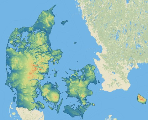
DHM/2015 now available nationwide
The Danish Styrelsen for Dataforsyning og Effektivisering has released the remaining areas of the new high-resolution Danish elevation model, extending the coverage to be national *. SCALGO is proud to announce that this updated model is now available in SCALGO Live under the name DHM/2015. The model is available for viewing, downloading and for creating workspaces anywhere in the country. The various derived models and hydrological layers will appear as they are ready, pending the completion of the model itself *.
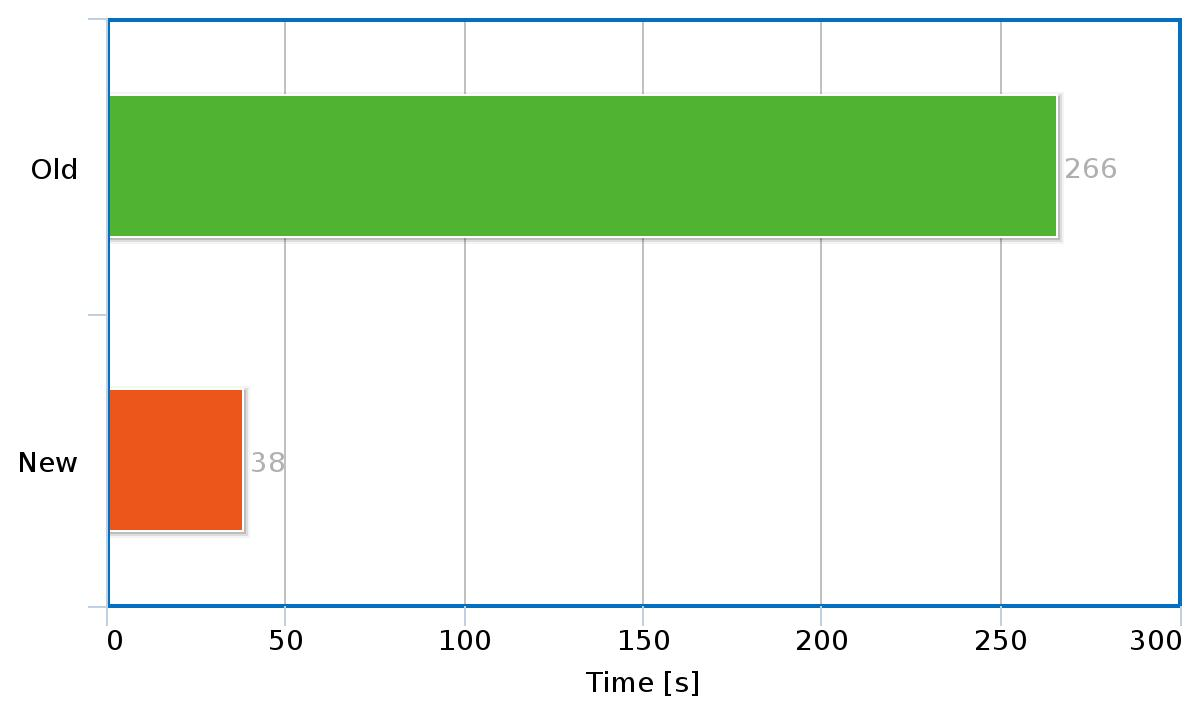
Computation performance significantly improved
To meet the challenges of a new significantly larger national model we have also rolled out numerous updates to our backend infrastructure that enable us to reduce workspace recomputation time by up to a factor 7 in standard configurations, and even more in some cases. The changes include: fundamental algorithmic improvements to the computation software, new servers with upgraded disks, processors and memory and updated scheduling technology that increases parallelism of computations. The combined effect of all these is that workspaces on the new high-resolution model can be handled in almost the same time as similar-sized workspace areas in the old model before the upgrade.
(*) A few minor sections are not yet available, these have been reported and we are waiting for updated data.
Hydrology on the new DHM/2015 model now available
We have added flow accumulation as well as watersheds derived from the new high-resolution (0.4 m) DHM/2015/Rain model of Denmark which includes the existing hydrological corrections. The model is currently available for Eastern Danmark. Interactive watershed queries using the watershed tool are also available.
We have also added a sea-level rise computation based on the DHM/2015/Sea model.
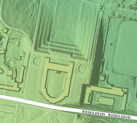
New DHM/2015 Model - now with buildings
We have added a new elevation model to SCALGO Live. The model is called DHM/2015/Buildings and is a version of the new 0.4m Danish elevation model with building footprints, but without hydrological corrections. Thus, it sits between the base DHM/2015 model and the DHM/2015/Rain model added earlier this month. The model is a good starting point if the hydrological corrections included in DHM/2015/Rain do not fit your needs. The nationwide elevation model Denmark from 2007 was renamed to Denmark/Buildings to ensure naming consistency.
New DHM Model
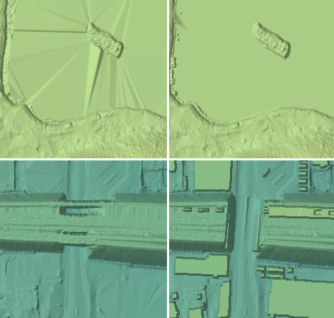
We have added the latest (as of early August 2015) version of the new 0.4m Danish elevation model DHM/2015 where (among other things) lakes have been flattened. The model is currently available for Eastern Denmark. More details are available at kortforsyningen. Additionally, we have put up two new models: DHM/2015/Rain and DHM/2015/Sea. They have been derived from the baseline model by adding building footprints, cutting them to the national coastline polygon and by burning the current set of hydrological corrections (DHyM/Tilpasninger) into the model. The result is a model that is much more suitable for hydrological computations through workspaces.
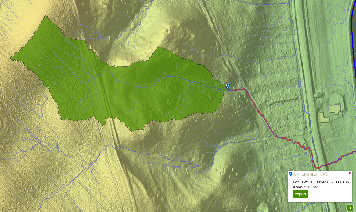
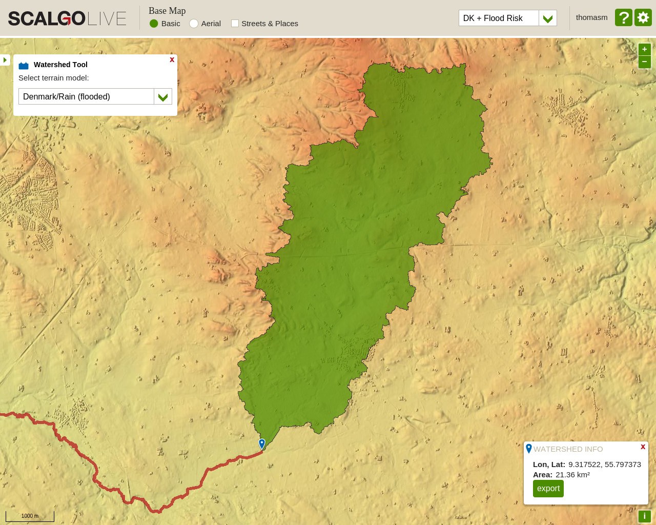
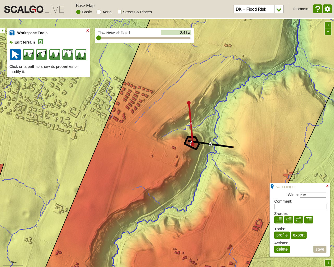
Watershed Tool
The watershed tool has gained some powerful features. You can now export the watersheds as a Shapefile by using the export button in the watershed information dialog. The result will be a simplified approximate version of the watershed polygon suitable for e.g. reports. The "area" field of this polygon contains the area of the original unsimplified watershed. Furthermore, you can now see the area of the watershed in the watershed information dialog (this is not yet supported for all layers).
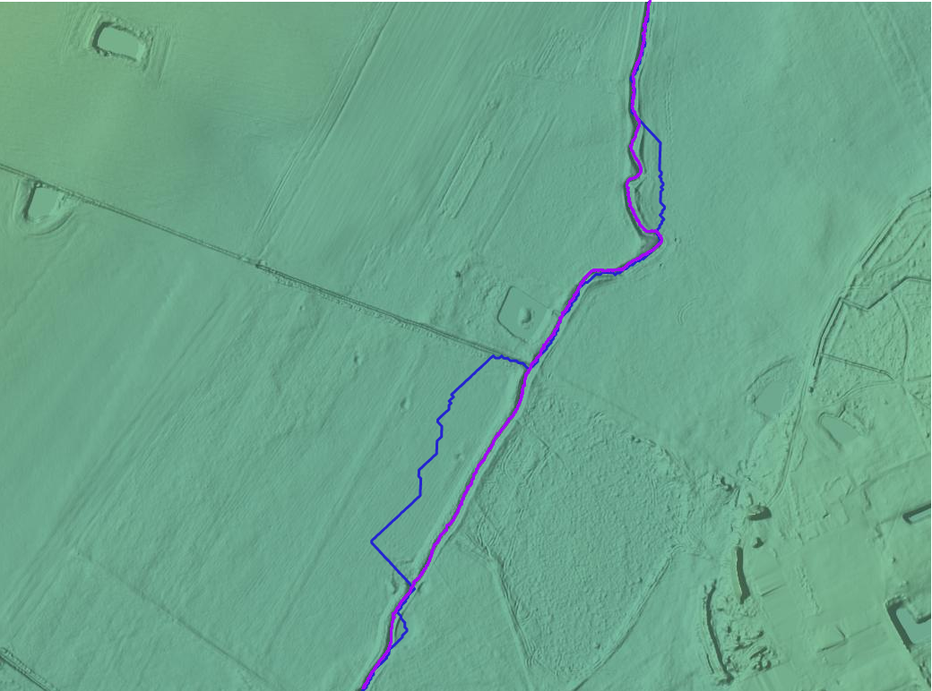
River network downloading
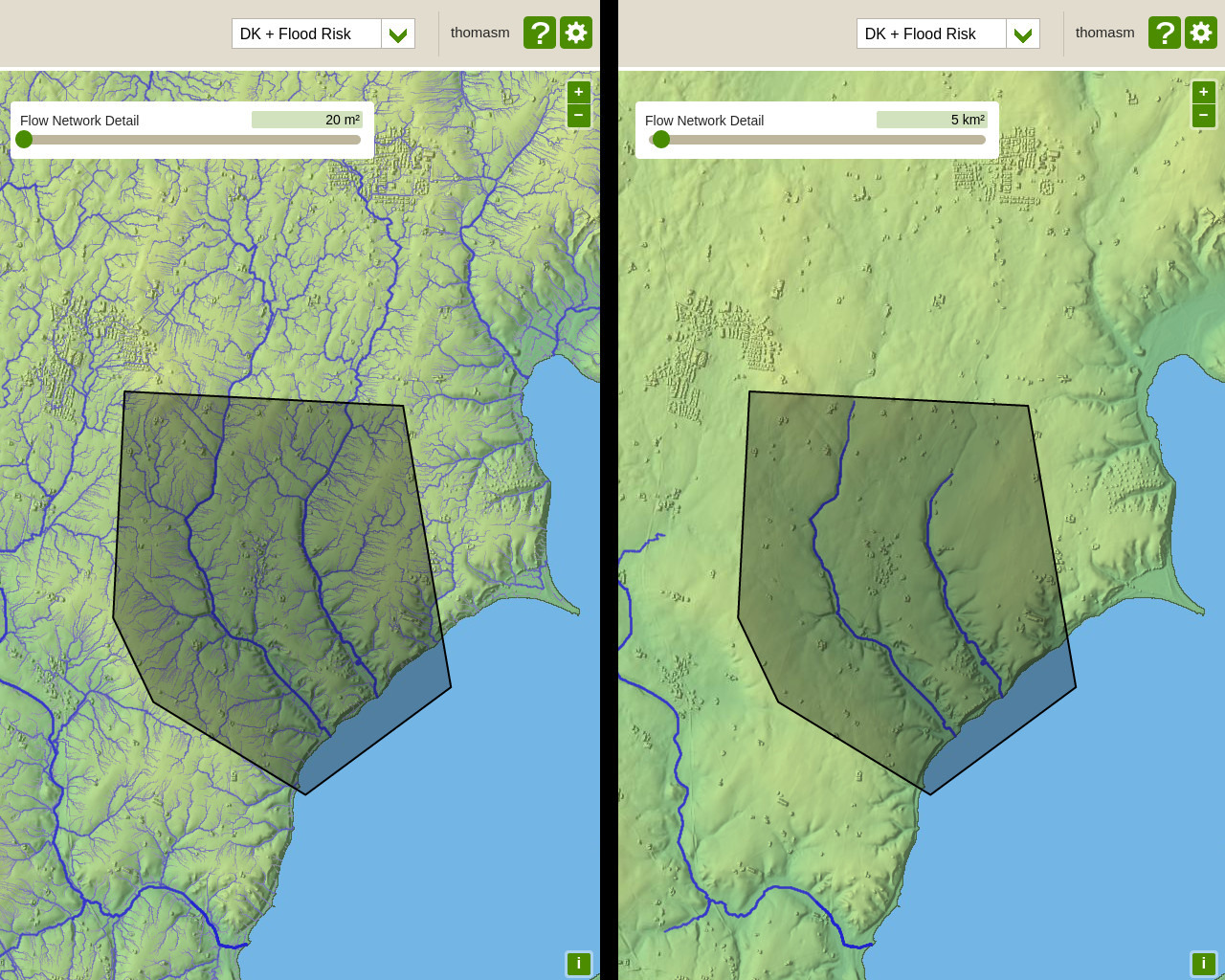
Flow Accumulation layer downloads now use the specified Flow Network Detail from the user interface. Thus, the level of detail of the downloaded vector file will match the level of detail displayed on the screen. This makes it easy to download just the main rivers and tributaries by setting an appropriate detail level. As before, the segments in the downloaded file have a field specifying their flow (that is, upstream area).
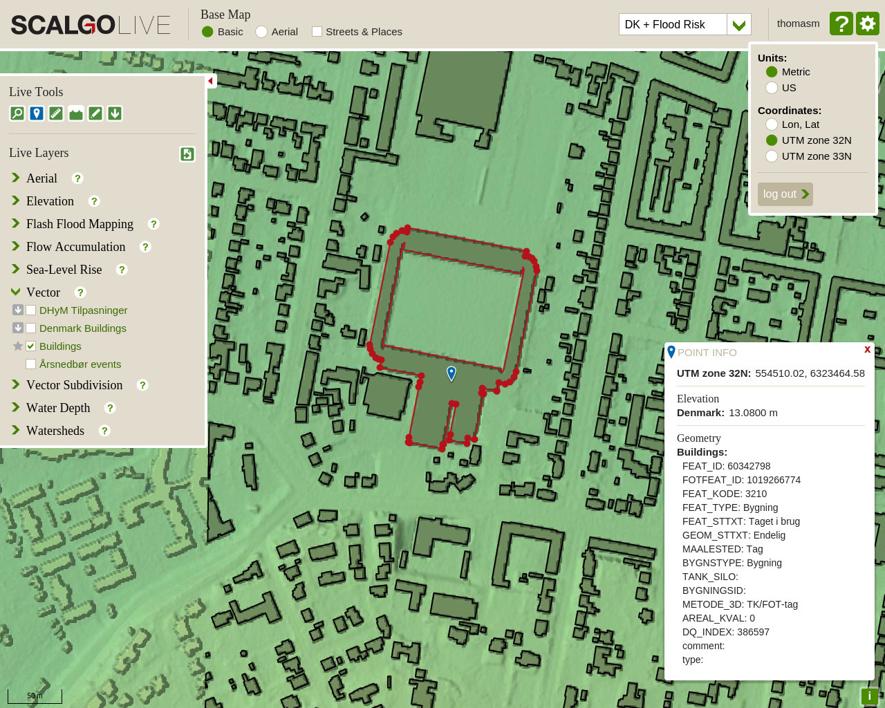
Point query tool
There are two bigger changes to the point query tool:
- You can now choose a coordinate system used for locations on the map. Currently we support UTM Zones 32N and 33N as well as lat/lon.
- Ad hoc layers, generated when dragging e.g. Shapefiles into the layer menu, are now queried along with the regular layers.
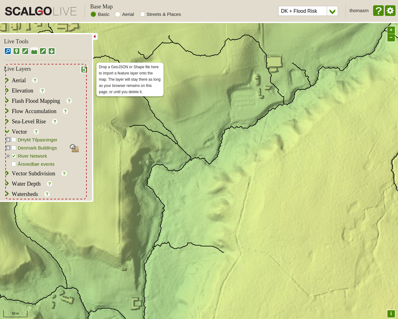
Ad hoc layers
You can now drag and drop Shapefiles (or a zip-file containing a Shapefile) into the layer selection menu on the left. This will import the features as a separate layer (an ad hoc layer) which allows you to quickly visualize and use reference data you might have lying around. Note that this feature isn't meant to be used for big Shapefiles, it's simply a quick in-browser way of reviewing smaller data sets. Ad hoc layers will disappear when refreshing the page.
Rank Display
For workspaces we now show the rank of overlapping segments so you can more easily order them in the order you want them applied to the model.
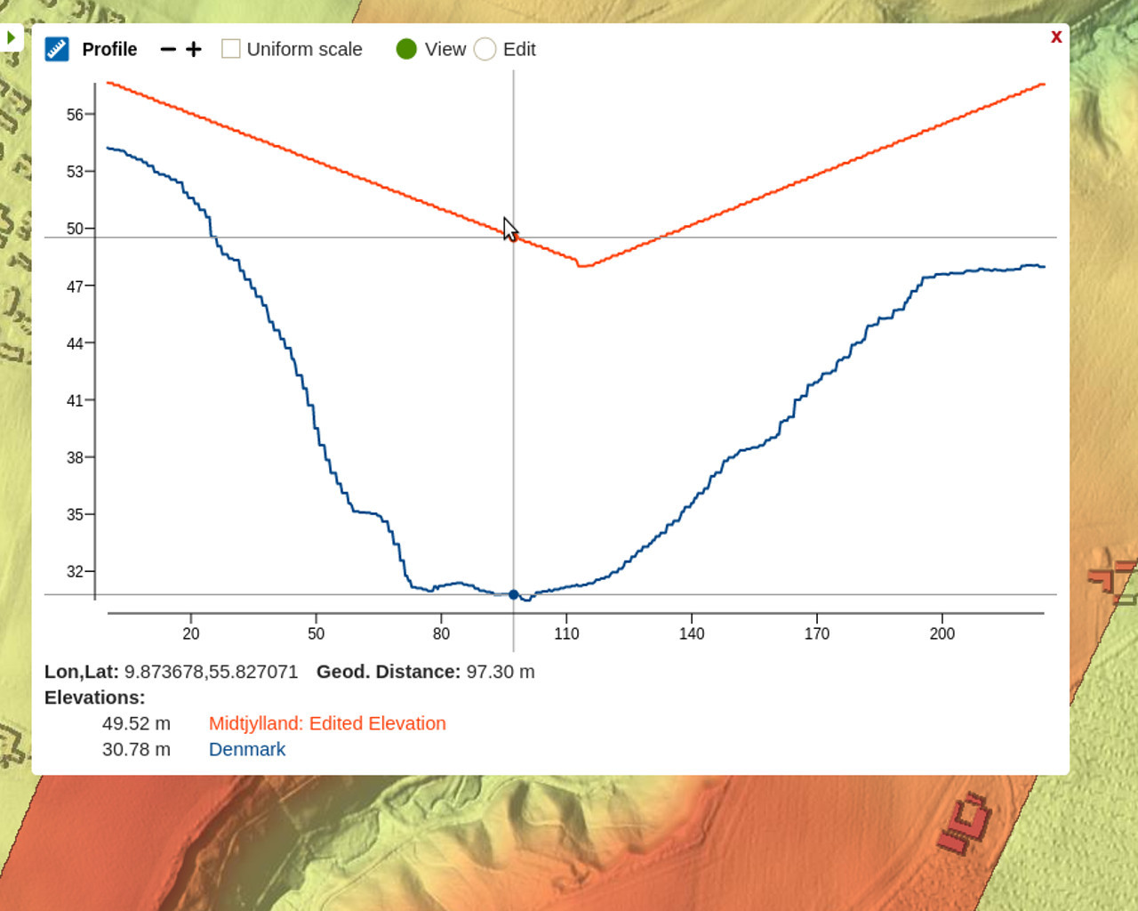
X/Y labels on profiles
Profiles now display an x-axis and y-axis, making it easier to work with the data.
Better support for vector files
We now support both MultiLineStrings and a number of the most common projections when importing files through drag and drop. If the projection you use for storing your data is not supported, just send us the EPSG code or some other information about the projection, and we can look into adding it.